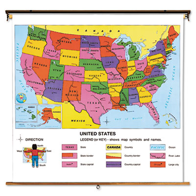
- Bright, contrasting state colors.
- City, town, interstate highway and landform labels.
- Supplemental physical feature and population density maps.
- Dry-erase-safe, tear-resistant Kimdura® synthetic paper.
- Easy-to-mount, heavy-duty roller.
Designed specifically for grades 4 through 12, this combination map features bright, contrasting state colors that help simplify intermediate and advanced social studies lessons. State capital, city and town as well as comprehensive interstate highway and landform labels enable teachers to formulate real-to-life geography projects for their students. Upper left and upper right supplemental maps provide highly detailed physical feature and population density information. Tear-resistant Kimdura® synthetic paper features a dry-erase-marker-safe finish. Heavy-duty spring-action roller mounts easily to map racks, rails and hooks.
Click on the Product No(s). below to view further information and order now!
|